Folio, 209 unnumbered leaves, including 34 double-page maps, hand
colored. Bound in original blind-stamped pigskin over wooden boards,
with the arms of Peter Falck of Fribourg.
Lilly Library call number:
G1005 1508 vault
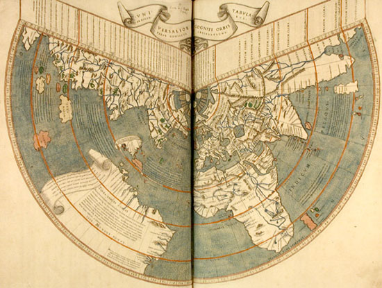
Johann Ruysch's world map--the first printed map delineating
any part of the New World based upon information derived from the
post-Columbian voyages